
The Annapurna Circuit is one of the diverse and chosen destinations in the Annapurna Region Nepal.
But to reach here is tough. You need some preparations that will make your journey easier .
The primary thing is definitely you have to know where it resides, how long is the journey, what about the altitude and challenges.
You need to know about the altitude, daily hiking distance, and how you will be crossing Thorong La Pass safely.
This circuit trek is also known as the ROUND ANNAPURNA TREK that will take you to the hidden gems of the Annapurna region.
It also encircles the 10th majestic mountain Annapurna which is simply marvelous.
With rapidly changing trails due to road development, the Annapurna Circuit Trek Distance can vary. However, the trekking distance will be from 83 KM to 230 KM.
Likewise, Max altitude at Thorong La Pass is 5,416 meters (17,769 ft) which is also the highest point of the trek.
You will require 6 to 18 days to cover the circuit trek.
The trek demands preparation but offers unforgettable cultural and natural rewards.
Quick Overview of the Annapurna Circuit
The Annapurna Circuit is a world-renowned trek that circles the majestic Annapurna Massif.
It offers the trekkers a wide variety of landscapes covering the lush subtropical forests to arid, high-altitude deserts.
You can check the quick overview for the Annapurna Circuit Trek:
- Total trekking distance
This trekking typically covers 160 to 230 km depending on road‑shortened sections.
- Max altitude at Thorong La Pass:
The maximum altitude is 5,416 meters (17,769 ft) which is also the highest point of the trek.
- Estimated days required:
Normally it requires 15 to 20 days and sometimes shorter if you are using jeeps/road stretches.
- Start and end points:
Annapurna Circuit Trek starts from Besisahar or Dharapani to Nayapul/Jomsom, ending in Pokhara or Kathmandu.
- Terrain overview:
The trail takes you through river valleys, terraced fields, rhododendron forests, and barren, rocky landscapes resembling the Tibetan plateau.
How Long is the Annapurna Circuit Trek?
Previously, the classic Annapurna Circuit Trek distance was approximately 230-260 kilometers (143-161 miles).
Starting from Bhulbhule and ending at Nayapul this trekking had many things to offer.
However, this full route is rarely walked today . It is because of the road developments that have altered the entire trekking experience.
But today, the modern Annapurna Circuit trek typically covers 136 to 180 kilometers (85 to 112 miles). This entirely depends on your starting and ending points.
Many trekkers now drive from Besisahar to Jagat, Dharapani, or even Chame, skipping the lower, less scenic stretches of the trail.
Similarly, after crossing Thorong La Pass which is at an altitude of 5,416 meters, it’s very common to take a jeep from Muktinath to Tatopani or Jomsom, further reducing the walking distance.
These adjustments allow trekkers to avoid dusty motor roads and focus on the most remote and breathtaking parts of the Himalayas, including the Marsyangdi Valley, Thorong La Pass, and Kali Gandaki Gorge.
We have given a short Altitude profile chart and acclimatization guide below :
Annapurna Circuit Altitude Profile Chart & Acclimatization Guide
The Annapurna Circuit offers you a gradual ascent taking you to a dramatic high pass crossing and rapid descent.
You have to know the elevation profile helps you prepare for altitude challenges and plan rest days effectively.
Key Highlights:
- Lowest point: 760–820 m (Besisahar/Pokhara area)
- Highest point: Thorong La Pass ( 5,416 m / 17,769 ft)
- Highest sleeping altitude: Thorong Phedi/High Camp (4,450–4,925 m)
- Biggest daily gain: Often on the approach to the pass or Ghorepani day
- Total elevation gain: Roughly 8,000-12,000 m (depending on route)
Daily Sleeping Altitudes for Annapurna Circuit Trek
Day | Sleeping Altitude |
|---|---|
Chame | 2,670 m / 8,760 ft |
Pisang | 3,200 m / 10,500 ft |
Manang | 3,540 m / 11,614 ft |
Manang (Acclimatization) | 3,540 m / 11,614 ft |
Yak Kharka | 4,050 m / 13,287 ft |
Thorong Phedi / High Camp | 4,450 – 4,925 m / 14,596 – 16,158 ft |
Muktinath | 3,800 m / 12,467 ft |
Tatopani | 1,200 m / 3,937 ft |
Ghorepani | 2,874 m / 9,429 ft |
Pokhara | 820 m / 2,690 ft |
How challenging is the Annapurna Circuit Trek?
Annapurna Circuit Trek is rated as the moderate trekking in Nepal .
This is a commercialized region where many trekkers choose this option every year.
You will find the well maintained trails taking you to the highest altitude of overnight Camp at 4450 meters.
This is the Thorang Phedi before the final pass to Thorang La Pass (5,416 m )
The section to Thorang La Pass is quite strenuous or challenging. It is definitely the final push so make sure you start trekking early.
Likewise, you cannot ignore the other risks that come along with altitude. You can check briefly below :
Altitude sickness
Acute Mountain Sickness (AMS) is the mildest and most common form of altitude illness.
This is caused by rapid ascent to high altitudes where your body suffers to adjust to lower oxygen levels.
It typically occurs above 2,500m (8,200 ft).
Main symptoms for altitude sickness are:
- Headache (most common, usually throbbing)
- Nausea, vomiting, loss of appetite
- Fatigue, weakness, dizziness/lightheadedness
- Trouble sleeping/insomnia
Note :Symptoms usually start within 6 to 24 hours of ascent. Do not ignore even the mild symptoms as it might cause greater difficulties further.
AMS Risk Zones (Acute Mountain Sickness)
- Moderate risk starts from 2,500–3,000m normally after Chame/Pisang.
- High risk above 3,500m is Manang onwards with major symptoms such as headache, nausea, fatigue.
Prevention Tips
There are preventive conditions for altitude sickness. It is better to be safe than sorry so make sure you :
- Ascend gradually . Always follow the rule “Climb high, sleep low”
- Stay well hydrated . You have to drink 3 to 4 liters of water per day.
- Eat carbohydrate-rich foods
- Avoid alcohol which makes your body dehydrated
- Take rest/acclimatization days especially in Manang
- Consider preventive medication like Diamox (Acetazolamide) . But make sure you consult your doctor before the trip
- Walk at a slow, steady pace and listen to your body
- Inform your guide immediately if symptoms appear. Do not ignore it.
How does the altitude affect trekking difficulty?
Altitude is one of the biggest factors affecting the difficulty of the Annapurna trek.
As you climb higher, the amount of oxygen in the air decreases, forcing your body to work harder.
This may lead to symptoms of Acute Mountain Sickness (AMS) if you ascend too quickly.
The key to a safe trek is gradual acclimatization.Move your body slowly at your pace.
The itinerary is designed below with a specific rest day in Manang and short trekking days before the pass for your ease.
Listen to your body, walk at a slow pace, drink plenty of water, and communicate any symptoms, such as headaches or dizziness, to your guide immediately.
A well-planned itinerary makes the challenge of altitude manageable for most fit trekkers.
Altitude Profile of the Annapurna Circuit
The altitude at Annapurna circuit cannot be ignored. The trek will take you from a relatively low elevation, around 820 meters (2,690 ft) in Besisahar. Then it slowly climbs at height over several days.
The journey is fascinating as you witness the trails, the lush forests, the majestic mountains and many more.
Then, you reach a critical acclimatization point in Manang at 3,540 meters (11,614 ft).
From this point here, the ascent becomes steeper. Now, you will be taking yourself towards the trek's highest point which is Thorong La Pass.
This section is challenging at a breathtaking point of 5,416 meters (17,769 ft).
After succeeding the pass, the trail descends rapidly towards Muktinath at 3,800 meters (12,467 ft).
This section has a lot to offer you as an immense relief and a completely different perspective of the mountains.
We have given below a detailed day-by-day breakdown with exact distances, gains, and sleeping altitudes for easy reference:
Day-by-Day Annapurna Circuit Itinerary with Distance and Elevation
The journey to Annapurna Trek is moderate.
You will enjoy the mix of walking and driving as it has many amazing scenes to offer.
Each day has something different to offer you like mountain views, Nepali villages, and peaceful scenery.
The plan takes you higher , bit by bit, which really helps your body get used to the altitude. That makes it much easier to cross the famous Thorong La Pass later in the trek.
If you want more information on Annapurna Circuit check out our full Annapurna Circuit trek itinerary and cost.
You will get all the practical advice you need.
Day 1: Kathmandu to Besisahar (Drive) to Chame
- Journey: Drive
- Distance: Approx. 240 km / 149 miles
- Duration: 9-10 hours
- Altitude: 2,670 m / 8,760 ft at Chame
This is the first day of your Circuit Journey.
Your Annapurna Circuit adventure begins with an amazing scenic drive from Kathmandu.
Leaving behind the bustling city energy, you’ll travel along the scenic Prithvi Highway, taking yourself through lush green hills and following the roaring Trishuli River.
Then you reach Besisahar which is the traditional starting point of the trek .You’ll switch to a sturdy 4WD jeep for the rugged journey to reach the final stretch to Chame.
Chame is also the administrative headquarters of Manang District.
This journey is long but the rewarding drive with the majestic landscapes will clearly be waiting for you in the Annapurna region.
Day 2: Chame to Pisang
- Trekking Distance: Approx. 14 km / 8.7 miles
- Duration: 5-6 hours
- Altitude: 3,200 m / 10,500 ft at Pisang
This is the first official trekking day on the Annapurna Circuit. It takes you a moderate 14-15 km hike with 5-6 hours from Chame (2,670 m) to Pisang (3,200-3,300 m).
You will be witnessing the beautiful scenes of the flowing Marsyangdi River through dense pine and rhododendron forests.
You can also capture the charming village of Bhratang here which is famous for its apple orchards. Don’t forget to enjoy fresh apple pie or juice once you are here.
As you gain altitude, the valley gradually opens up, taking you towards the breathtaking views of Annapurna II, Lamjung Himal, and Pisang Peak.
The day concludes in the beautiful village of Pisang (Lower or the more scenic Upper Pisang) where you will get to see the traditional stone houses and panoramic mountain views very closely..
Day 3: Pisang to Manang
- Trekking Distance: Approx. 17 km / 10.5 miles (via lower route)
- Duration: 6-7 hours
- Altitude: 3,540 m / 11,614 ft at Manang
You trek from Pisang (3,200-3,300 m) towards Manang (3,540 m) covering approx. 17-20 km .It normally takes 6-8 hours depending on the route chosen.
Once you reach here, you will have two options:
The easier lower trail along the valley floor or the more challenging and highly recommended upper route through the ancient villages of Ghyaru and Ngawal.
To be fair, the upper path offers you unparalleled panoramic views of the Annapurna range, including Annapurna II, III, Gangapurna, and Pisang Peak.
You will also see the pine forests, stone houses, and high ridges.
Both routes meet near Braga which is a charming village with a historic monastery before you reach Manang.
You will see the landscape shift noticeably here to a drier, barren high-altitude valley in the rain shadow of the Annapurna Massif.
The vast meadows, glacial streams, and towering peaks surrounding the large settlement of Manang look amazingly beautiful here.
Day 4: Acclimatization Day in Manang
- Trekking Distance: Varies based on activity
- Duration: N/A (Rest Day)
- Altitude: 3,540 m / 11,614 ft
You need rest after long walking hours while you are trekking. For the Annapurna Circuit trek,day 4 is very important.
You can rest in Manang on the fourth day of your trekking. Acclimatization helps your body adjust to the changing altitude . This is extremely necessary before you take your journey towards Thorang La Pass.
Resting doesn’t mean you need to sleep all day. On this day you can hike to Gangapurna Lake, Praken Gompa (Hundred Rupee Lama), or nearby viewpoints.
These short walks follow the "climb high, sleep low" principle which improves acclimatization .
It later rewards you with stunning views of the Annapurna range, Gangapurna Glacier, and surrounding peaks because your body is now not struggling like it did before.
Spending an extra night in Manang significantly lowers the risk of altitude sickness and prepares you for the higher elevations ahead.
Day 5: Manang to Yak Kharka
- Trekking Distance: Approx. 10 km / 6.2 miles
- Duration: 4-5 hours
- Altitude: 4,050 m / 13,287 ft at Yak Kharka
On this day you will be traveling from Manang towards Yak Kharka. This destination will slowly take you to a gradual ascent into the high Himalayan alpine zone.
As you leave the Marsyangdi Valley behind, you will love to witness the open grasslands, rocky terrain, and scattered juniper shrubs.
The trail you walk offers spectacular views of the surrounding snow-capped peaks. You will also spot grazing yaks.
This is also one of the reasons for why it is named as Yak Kharka ("Yak Pasture") .
Day 6: Yak Kharka to Thorong Phedi or High Camp
- Trekking Distance: Approx. 6 km / 3.7 miles
- Duration: 3-4 hours
- Altitude: 4,525 m (Phedi) / 4,925 m (High Camp)
You will be walking a very short distance today. But it plays a very crucial role in preparing you for the crossing of Thorong La Pass the following morning.
After you leave Yak Kharka, you'll gradually ascend at heights with impressive views of the surrounding Himalayan peaks.
The trail becomes quite steeper as you approach Thorong Phedi, whose name means "foot of the pass" .
This is also the final major stop before the highest point of the Annapurna Circuit.
Depending on your fitness level, weather conditions, and your guide's recommendation, you may continue for about an hour to High Camp.
Then, spend the night at High Camp that shortens the ascent to Thorong La Pass the next day.
You will also be sleeping at a higher altitude where temperatures are colder and the air is thinner.
Whether you stay at Thorong Phedi or High Camp you need proper hydration, a slow pace, and adequate rest.
This ensures a safe and successful pass crossing the next day.
Day 7: Thorong Phedi to Thorong La Pass to Muktinath
- Trekking Distance: Approx. 16 km / 10 miles
- Duration: 8-9 hours
- Altitude: 5,416 m (Thorong La Pass) / 3,800 m (Muktinath)
Today is the most demanding and rewarding day of the Annapurna Circuit Trek.
You will begin your ascent before dawn, following a steep but well-marked trail toward Thorong La Pass (5,416 m), one of the highest trekking passes in the world.
Walking at a slow, steady pace is essential as the thin mountain air makes every step more challenging.
Reaching the colorful prayer flags at the summit is a memorable milestone, offering breathtaking panoramic views of the Annapurna and Dhaulagiri ranges.
After taking time to celebrate your achievement and capture the incredible scenery, you'll begin the long descent into the dry, dramatic landscapes of the Kali Gandaki Valley.
The day ends at Muktinath (3,800 m), one of Nepal's most sacred pilgrimage sites for both Hindus and Buddhists.
Famous for its ancient temple, 108 holy water spouts, and eternal flame, Muktinath provides a peaceful and meaningful conclusion to this unforgettable day of high-altitude trekking.
Day 8: Muktinath to Tatopani (via Jeep or Trek)
- Journey: Drive
- Distance: Approx. 95 km / 59 miles
- Duration: 5-6 hours drive
- Altitude: 1,200 m / 3,937 ft at Tatopani
After exploring the Muktinath temple complex, you will take a jeep. Then you will be moving towards the Kali Gandaki Gorge .
The way and the scenes you witness are the perfection in itself. If you don’t know this, Kali Gandaki Gorge is also one of the world's deepest gorges.
Then, you'll pass through villages like Jomsom and Marpha. This destination is famous for its apples and architecture.
The day ends in Tatopani, which means "hot water" in Nepali. You can relax your tired muscles in the natural hot springs here.
Day 9: Tatopani to Ghorepani
- Trekking Distance: Approx. 17 km / 10.5 miles
- Duration: 7-8 hours
- Altitude: 2,874 m / 9,429 ft at Ghorepani
The trail climbs once again today. You will leave the river valley behind and ascend through terraced fields and dense rhododendron forests.
This is a challenging day. It is an uphill trekking, which marks the final climb of your journey.
Once you reach the large village of Ghorepani, you will feel a sigh of relief. It feels like an achievement.
Ghorepani is also the gateway to the famous Poon Hill viewpoint which is very famous for sunrise.
Day 10: Ghorepani to Poon Hill to Nayapul – Drive to Pokhara
- Trekking Distance: Approx. 12 km / 7.5 miles
- Duration: 6-7 hours
- Altitude: 3,210 m (Poon Hill) / 820 m (Pokhara)
You hike early in the morning that takes you up to Poon Hill.
This destination is mainly famous for the sunrise seen over the Himalayas in Annapurna and Dhaulagiri mountain ranges.
After breakfast you get back to Ghorepani. On your final descent you will witness beautiful forests and villages to Nayapul.
From there you take a short drive . Finally you will reach the lakeside city of Pokhara, where your incredible trek wraps up .
Distance and Altitude Table of Annapurna Circuit Trek
This table provides a quick reference for the daily distance, duration, and altitude changes on a typical 10-day Annapurna Circuit trek:
Day | Route | Distance | Cumulative Distance (km) | Duration (hrs) | Sleeping Altitude (m / ft) | Altitude Gain / Loss |
|---|---|---|---|---|---|---|
1 | Drive Kathmandu to Chame | 240 km / 149 mi (drive) | 240 (mostly drive) | 9–10 | 2,670 m / 8,760 ft | N/A |
2 | Chame to Pisang | 14 km / 8.7 mi | 254 | 5–6 | 3,200 m / 10,500 ft | +530 m |
3 | Pisang to Manang | 17 km / 10.5 mi (option for upper route) | 271 | 6–7 | 3,540 m / 11,614 ft | +340 m |
4 | Acclimatization in Manang | Varies (side hikes 5–8 km) | 271+ | Rest / light | 3,540 m / 11,614 ft | Minimal |
5 | Manang to Yak Kharka | 10 km / 6.2 mi | 281 | 4–5 | 4,050 m / 13,287 ft | +510 m |
6 | Yak Kharka to Thorong Phedi / High Camp | 6 km / 3.7 m | ~287 | 3–4 | 4,525 m (Phedi) or 4,925 m (High Camp | +475 m / +400 m |
7 | Thorong Phedi to Thorong La Pass to Muktinath | 16 km / 10 mi | 303 | 8–9 | 3,800 m / 12,467 ft | +891 m / -1,696 m (approx.) |
8 | Muktinath to Tatopani (jeep/drive) | ~95 km / 59 mi (drive) | N/A (mixed) | 5–6 | 1,200 m / 3,937 ft | Major descent |
9 | Tatopani to Ghorepani | 17 km / 10.5 mi | (trek resumes) | 7–8 | 2,874 m / 9,429 ft | +1,674 m |
10 | Ghorepani to Poon Hill to Nayapul + drive to Pokhara | 12 km / 7.5 mi (trek) | ~ | 6–7 | 820 m / 2,690 ft (Pokhara) | +336 m / -2,054 m |
- Distances are approximate and can vary by exact route choices (upper/lower trails, side trips).
- Cumulative trekking distance for the full classic circuit is 160-230 km depending on road usage.
- Always prioritize sleeping altitude for acclimatization. Never sleep more than 500m higher than the previous night when above 3,000m.
Optional Variations to the Route
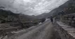
The classic circuit offers many options for the adventure. But, you can also add side trips to make your experience more worth it .
These variations add to the trek's distance and difficulty but reward you with unique landscapes and fewer crowds.
Tilicho Lake side trip:
The journey to Annapurna Circuit with Tilicho Lake Trek includes a challenging 2-3 day detour from Manang. This is the way to one of the world’s highest lakes, Tilicho.
It significantly increases the overall difficulty, but the experience you will get is unforgettable and worth it .
Short circuit exit via Jomsom flight:
To save time, you can fly from Jomsom back to Pokhara after crossing the pass. This shortens the trek by 2-3 days, skipping the trek down to Tatopani and Ghorepani.
Route via Ngawal or Upper Pisang:
Between Pisang and Manang, you can choose the higher and more scenic route via Ghyaru and Ngawal.
This path offers superior views of the Annapurna range. It is a great way to aid acclimatization, though it is more strenuous and challenging.
Let our local guides plan your Annapurna Circuit Trek
We have professional license guides working with us for many years.
By working with our trusted guides, you’ll follow a well-paced, flexible itinerary designed for both safety and enjoyment.
They handle all the logistics while helping you discover side-trips like Tilicho Lake. They make sure you stay on the right path, physically and culturally.
Whether you're a first-time trekker or an experienced hiker, plans can be customized to your fitness level, rest-day preferences, and desired experiences.
Planning the logistics, permits, and accommodation for the Annapurna Circuit can be complex. Letting our expert local trek leaders handle the details allows you to focus purely on the adventure.
Our team at Mountain Routes ensures your itinerary is perfectly paced for safety and enjoyment.
We manage all the logistics so you can immerse yourself in the culture and landscapes of the Annapurna region with complete peace of mind.
Connect with us to craft your personalized Himalayan trek.
Conclusion
Annapurna Circuit Trek in Nepal takes you to the most diverse landscapes, cultures, and altitude zones. It covers approximately 160-230 km (100–145 miles). But the distance definitely depends on your starting and ending points.
If you are trekking the Annapurna Circuit , it is compulsory to know the distance and altitude profile .
You have to plan a safe and enjoyable adventure to avoid risks.
On this journey, knowing the daily distances, elevation gains, and acclimatization stops helps you prepare physically, reduce the risk of altitude sickness, and choose an itinerary that matches your fitness level.
FAQs
What is the total distance of the Annapurna Circuit Trek?
The full classic Annapurna Circuit Trek covers approximately 190-230 km (118-145 miles) if you walk entirely from Besisahar to Birethanti/Naya Pul.
However, most modern itineraries are 160-180 km (100-112 miles) over 12–15 days, as jeeps, buses, or flights commonly skip the lower motorable road sections these days.
Daily walking distances normally range from 10-15 km, with the exact length depending on your starting/ending points, pace, and optional side trips.
How high is Thorong La Pass?
Thorong La Pass is the highest point at Annapurna Circuit. It takes you to 5,416 meters (17,769 feet) making it higher than Everest Base Camp (5,364 m / 17,598 ft) by 52 meters.
At this altitude, oxygen levels are roughly half of sea level, which is why you need proper acclimatization on the Annapurna Circuit.
Crossing it is a major achievement, but it requires starting early, often pre-dawn, to avoid afternoon winds.
Be cautious as altitude sickness risks increase sharply above 5,000 m.
How many days is ideal for the Annapurna Circuit?
An ideal trek lasts between 12 and 16 days for Annapurna Circuit Trek .
This 12 to 16 days itinerary gives enough time for proper acclimatization, especially around Manang, and allows for a comfortable pace without rushing.
Shorter 10-day itineraries are possible but are more physically demanding.

No comments yet. Be the first to share your thoughts!