Contents
Kanchenjunga Circuit Trek represents ultimate remote Himalayan adventure exploring Nepal's far eastern mountains including world's third highest peak (8,586m).
This demanding 23-day expedition visits both North and South Base Camps crossing Sele Le Pass (4,290m) through pristine wilderness rarely visited by international trekkers. Restricted area status requiring special permits and mandatory guide services preserves cultural authenticity and environmental integrity.
Trek combines spectacular mountain scenery including five 8,000-meter peaks with Tibetan Buddhist culture, diverse ecosystems, and genuine wilderness experience creating bucket-list adventure for experienced trekkers seeking solitude beyond mainstream routes.
Geographic and Historical Context
World's Third Highest Mountain
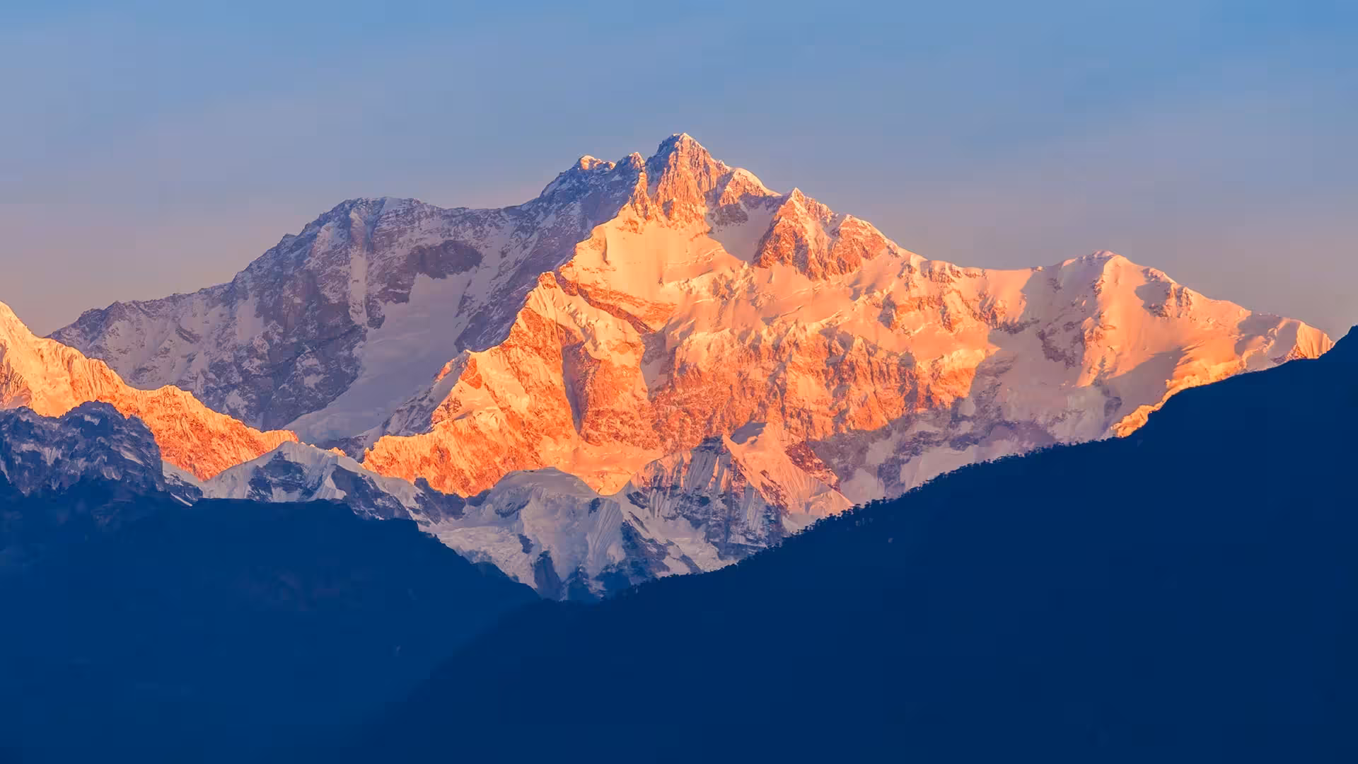
Kanchenjunga (8,586m) ranks third globally after Everest (8,849m) and K2 (8,611m). Name derives from Tibetan meaning "Five Treasures of Snow" representing five peaks composing massive mountain. Before 1852 calculations, Kanchenjunga considered world's highest peak. Great Trigonometrical Survey measurements confirmed Everest's superior height though Kanchenjunga remained Himalayan giant.
First ascent occurred May 25, 1955 by British expedition members George Band and Joe Brown. Respectful climbers traditionally stop few meters below summit honoring Sikkim's sacred beliefs. Understanding mountaineering history and religious significance contextualizes trekking within broader cultural-environmental framework.
Kanchenjunga Conservation Area
Established 1997, Kanchenjunga Conservation Area protects 2,035 square kilometers in Taplejung District. Conservation goals include biodiversity protection, sustainable resource management, and cultural preservation. Area harbors snow leopards, red pandas, Himalayan black bears, musk deer, and over 250 bird species.
Restricted area status opened 1988 controls visitor numbers preventing environmental degradation and cultural disruption. Special permits costing approximately $20 per person per week (first week), $25 per week thereafter required beyond standard TIMS and conservation area permits. Understanding regulatory framework helps appreciating conservation efforts balancing tourism and protection.
Remote Wilderness Character
Kanchenjunga region remains Nepal's least-developed trekking area. Limited infrastructure, challenging access, and restricted permits maintain genuine wilderness atmosphere. Few teahouses operate compared to mainstream routes. Some sections require camping though basic lodge networks exist along main trails. Understanding remoteness helps realistic expectations about facilities and services.
Trails see dramatically fewer trekkers than Everest or Annapurna creating solitude impossible on popular routes. During quiet seasons, encountering other international trekkers rare. This isolation appeals to those seeking authentic wilderness experiences avoiding crowded tea houses and commercialized trails.
Circuit Route and Itinerary Overview
Journey to Trailhead
Trek begins with flight Kathmandu to Bhadrapur (eastern Nepal) followed by long jeep journey to Taplejung (2,420m). Alternative involves domestic flight to Suketar (weather permitting) eliminating road travel though flights frequently cancel. Road journey takes 8-10 hours through varied landscapes. Understanding access challenges contextualizes remote location.
North Base Camp Route (Days 4-13)
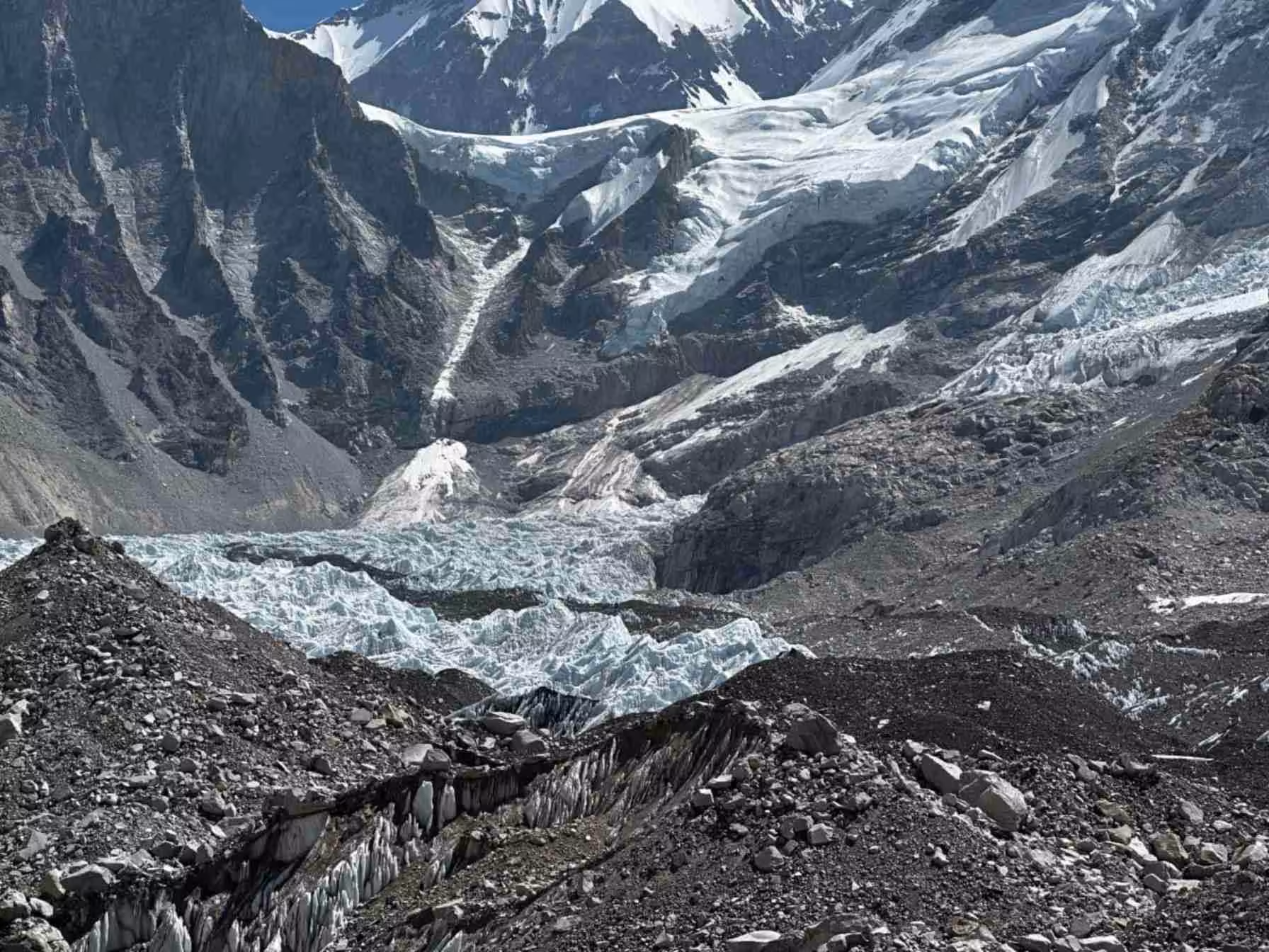
Trek ascends Tamur River valley through Chhirwa (1,185m), Lelep (1,860m), Amjilosa (2,510m), and Gyabla (2,730m) reaching Ghunsa (3,595m). Ghunsa represents major settlement with monastery, lodges, and acclimatization opportunities. Continuation climbs to Khambachen (4,100m) and Lhonak (4,785m) before reaching Pangpema North Base Camp (5,140m).
Daily walking averages 5-7 hours over varied terrain from subtropical forests to alpine zones. Wildlife sightings possible including blue sheep, Himalayan tahr, and various birds. Understanding ecological transitions enriches appreciation beyond scenery.
Acclimatization Strategies
Critical rest day at Ghunsa allows altitude adaptation before higher elevations. Some itineraries include additional acclimatization at Khambachen. Conservative ascent profile minimizes altitude sickness risks though individual responses vary. Recognizing symptoms and accepting rest days prevents serious problems.
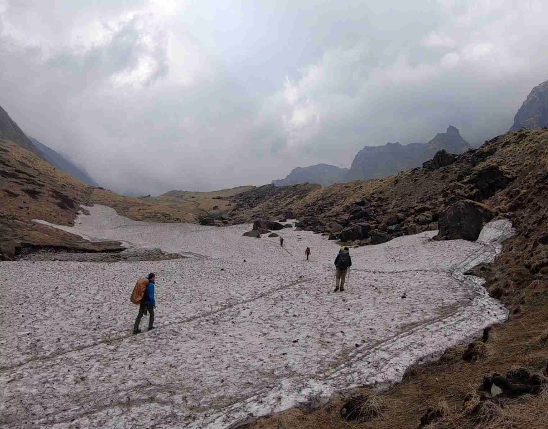
Sele Le Pass Crossing (Days 14-15)
Circuit's most challenging section crosses Sele Le Pass (4,290m) connecting north and south routes. Steep ascent from Ghunsa followed by dramatic descent to Tseram (3,868m). Pass remains snow-covered much of year requiring appropriate timing and conditions. Understanding technical challenges helps preparation.
South Base Camp Route (Days 16-21)
From Tseram, route visits Ramche and Oktang (South Base Camp, 4,730m) before descending through Torongten (2,980m), Yamphuding (2,080m), Khebang (1,910m) to Khamdime (1,500m). Final sections traverse subtropical forests and agricultural areas creating dramatic ecological contrasts with high-altitude sections.
Cultural Highlights and Experiences
Tibetan Buddhist Communities
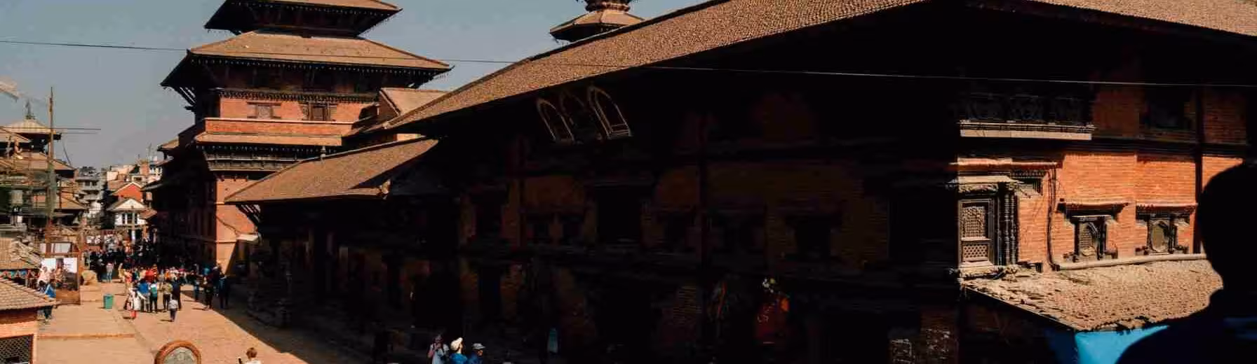
Villages maintain Tibetan Buddhist traditions including monasteries, prayer flags, mani walls, and chortens. Ghunsa features impressive monastery with active monk community. Understanding basic Buddhist concepts enhances appreciation for observed practices. Respectful behavior near religious sites demonstrates cultural sensitivity.
Traditional architecture uses stone construction with Buddhist decorative elements. Agricultural practices emphasize barley, potatoes, and yak herding adapted to harsh mountain environment. Observing daily village life provides insights into resilient communities maintaining traditional lifestyles.
Limited Infrastructure and Authentic Experiences
Basic teahouse accommodations feature simple rooms, shared facilities, and limited menus. Expecting rustic conditions rather than comfortable lodges prevents disappointment. However, authentic mountain hospitality compensates material simplicity. Understanding infrastructure limitations creates appropriate mindset appreciating what exists rather than lamenting what doesn't.
Electricity and communication limited or absent throughout much of route. Digital disconnection transforms potential frustration into opportunity for present-moment engagement with surroundings. Understanding that remoteness defines Kanchenjunga's appeal helps embracing limitations.
Physical Demands and Preparation
Extreme Difficulty Level
Kanchenjunga Circuit ranks among Nepal's most challenging treks. Twenty-three day duration, high maximum elevations (5,140m North Base Camp), remote location, and Sele Le Pass crossing demand excellent fitness and previous high-altitude experience. Daily elevation changes often exceed 1,000 meters creating sustained physical demands.
Only physically fit, experienced trekkers should attempt. Previous successful completion of demanding multi-week treks at altitude essential. Understanding extreme difficulty prevents unrealistic attempts risking safety and enjoyment.
Altitude Challenges
Maximum elevations approaching 5,200 meters create serious altitude exposure. Even with conservative ascent profiles, altitude sickness risks remain significant. Previous high-altitude experience highly beneficial though not guaranteeing success. Recognizing symptoms early and descending when necessary prevents life-threatening complications.
Proper acclimatization requires patience accepting rest days and conservative pacing. Understanding that altitude affects everyone differently regardless of fitness encourages humble approach respecting mountain environment.
Best Trekking Seasons
Autumn Optimal Period
October-November provides peak conditions with post-monsoon clarity offering spectacular mountain views. Comfortable daytime temperatures though cold nights at high elevations. Sele Le Pass generally snow-free though conditions vary annually. Understanding seasonal patterns helps timing decisions.
Spring Alternative
April-May offers second-best window with blooming rhododendrons at lower elevations and generally stable weather. Pre-monsoon humidity can reduce visibility compared to autumn. Warmer temperatures create more comfortable conditions though increased insect activity at lower elevations.
Monsoon and Winter Impossibility
June-September monsoon brings heavy rainfall creating dangerous trail conditions, landslide risks, and leeches. Most teahouses close. Sele Le Pass potentially impassable. Winter (December-March) features extreme cold, deep snow blocking pass, and closed teahouses. Understanding seasonal limitations prevents dangerous attempts.
Permits and Logistics
Required Documentation
Kanchenjunga Conservation Area Permit costs NPR 2,000 plus special restricted area permit approximately $20 per week first week, $25 per week thereafter. TIMS card NPR 2,000. Total permits approximately $100-150 for 23-day trek. Valid passport, comprehensive insurance covering 6,000+ meters, and visa documentation essential.
Mandatory Guide Requirements
Restricted area regulations prohibit independent trekking requiring registered guide throughout. Minimum two-person groups though solo travelers join existing departures or hire private guides. Understanding mandatory guide requirement helps budgeting and planning.
Costs and Budgeting
Complete 23-day organized treks typically $2,500-4,000 per person including permits, guide, porter, accommodation, meals, and domestic flights/transportation. Costs vary by group size, service level, and camping versus teahouse preference. Budget planning should include substantial emergency funds given remote location.
Frequently Asked Questions
How does Kanchenjunga compare to Everest Base Camp?
Much more remote, challenging, and less crowded. Higher maximum elevation at North Base Camp. Longer duration and greater physical demands. Appeals to experienced trekkers seeking wilderness beyond mainstream routes.
Is previous high-altitude experience necessary?
Absolutely essential. This extremely demanding trek unsuitable for first-time high-altitude trekkers. Previous successful completion of demanding treks at 4,500+ meters minimum recommended.
What about teahouse availability?
Basic teahouse network exists along main routes though facilities very simple. Some sections may require camping depending on season and conditions. Expecting minimal infrastructure prevents disappointment.
Can itinerary be shortened?
Not recommended. Twenty-three days allows proper acclimatization for extreme elevations. Shorter itineraries increase altitude sickness risks dramatically. Some operators offer north-only or south-only variations reducing to 18-20 days.
What if Sele Le Pass is blocked?
Snow conditions can render pass impassable requiring retracing north route or waiting for improvement. Building schedule flexibility essential. Understanding that weather dictates possibilities prevents frustration.
What wildlife might I see?
Blue sheep common at higher elevations. Himalayan tahr, musk deer possible. Red pandas inhabit forests though rarely seen. Snow leopards exist though sightings extremely rare. Diverse bird species throughout elevation zones.

No comments yet. Be the first to share your thoughts!