
Lo Manthang trek delivers comprehensive Upper Mustang experience combining cultural immersion in ancient Tibetan kingdom with spectacular Himalayan desert landscapes.
This 16-day journey navigates dramatic terrain from Jomsom through traditional villages reaching walled capital Lo Manthang before returning via alternate routes. Trek showcases Dhaulagiri and Nilgiri mountain views, medieval architecture, Buddhist monasteries, and authentic traditional lifestyles preserved through centuries of isolation creating transformative cultural adventure.
Trek Overview and Highlights
Journey Summary
Complete circuit begins Kathmandu with scenic Pokhara stopover before flying Jomsom initiating actual trekking. Route ascends gradually through Kagbeni, Chele, Geling, and Charang reaching Lo Manthang at 3,840 meters. Two nights Lo Manthang allow acclimatization and thorough exploration. Return journey follows different route through Dhakmar and Syangboche before rejoining ascent trail at Chhuksang. Total trekking distance approximately 120 kilometers over 10 active walking days.
Elevation range 2,810-4,020 meters requires proper acclimatization though no extreme technical climbing necessary. Daily walking averages 5-7 hours over established trails suitable for moderately fit trekkers. Upper Mustang's restricted status demands special permits, registered guides, and organized group participation making independent trekking impossible.
Cultural Highlights
Ancient walled city Lo Manthang represents trek's cultural centerpiece featuring medieval Tibetan architecture, active monasteries, and traditional community life. Three major gompas—Jhampa, Thupchen, and Chhoeda—contain irreplaceable 15th-century Buddhist art including elaborate murals and religious artifacts. Former raja's palace demonstrates noble Tibetan architecture within defensive city walls.
Traditional villages along route maintain agricultural lifestyles cultivating barley and buckwheat in harsh high-altitude desert environment. Flat-roofed houses, narrow alleyways, and whitewashed buildings create photogenic settings revealing centuries-old architectural traditions. Observing daily village activities provides insights into resilient communities adapting to extreme climatic conditions.
Natural Landscapes
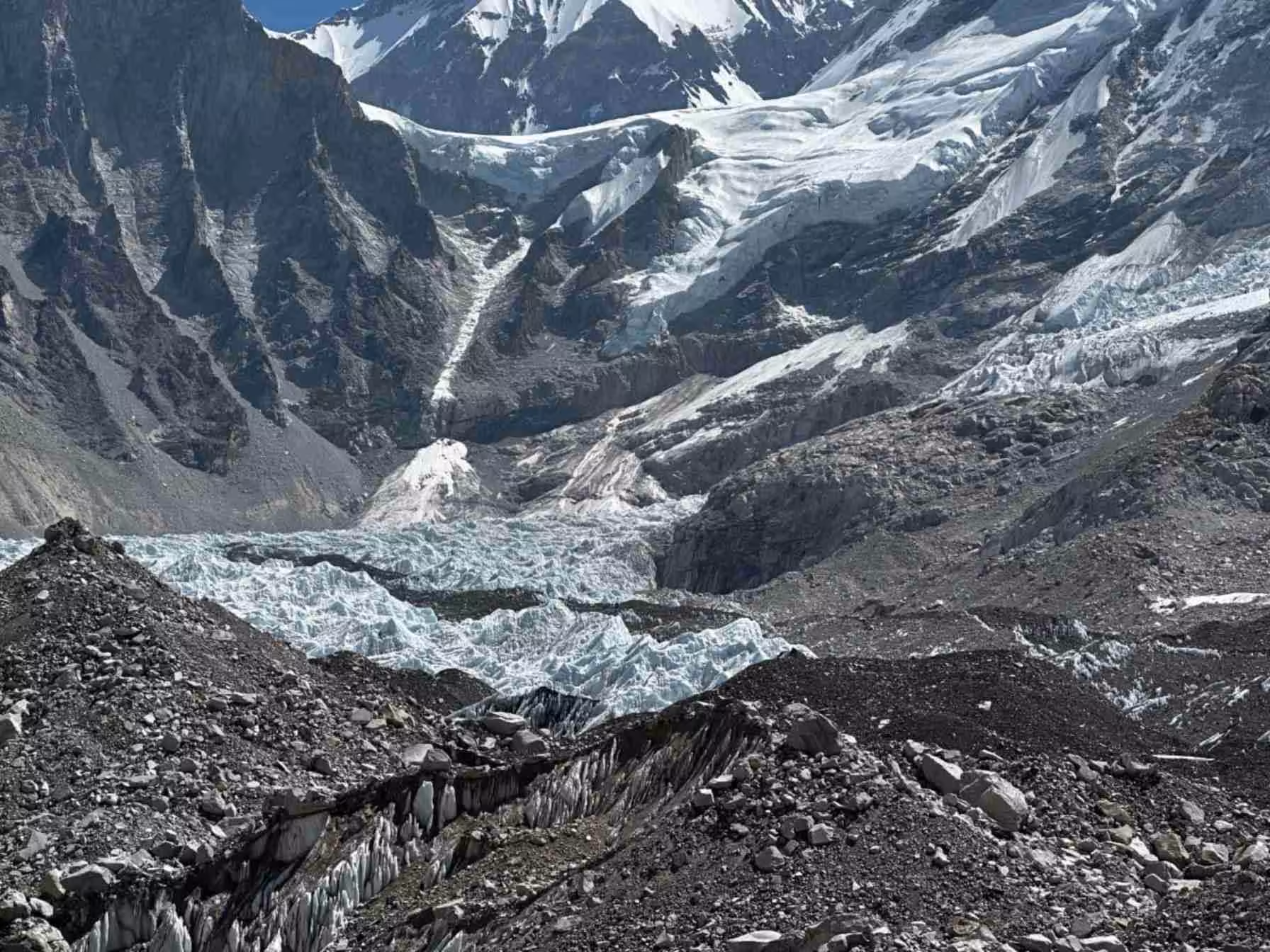
Rain shadow geography creates dramatic desert terrain contrasting sharply with lush lower elevation forests. Eroded clay formations display spectacular earth tone layers—reds, ochres, grays, and whites—creating surreal badlands topography. Kali Gandaki River valley carves world's deepest gorge between towering Annapurna and Dhaulagiri massifs.
Mountain views dominate northern and southern horizons. Nilgiri Himal appears prominently throughout trek while Dhaulagiri's massive bulk provides dramatic backdrop. Understanding geographic forces creating unique landscapes adds scientific appreciation to aesthetic enjoyment.
Detailed Itinerary Breakdown
Days 1-2: Kathmandu and Pokhara Preparation
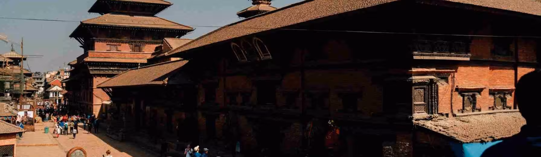
Arrival Kathmandu includes airport pickup, hotel transfer, and initial briefings. Free time allows exploring capital's cultural attractions and final gear preparations. Second day features six-hour scenic drive to Pokhara crossing varied terrain and traditional villages.
Pokhara evening provides lakeside relaxation and sightseeing before early morning flight next day. Understanding flights often delay due weather requires flexible scheduling and patience.
Day 3: Jomsom Flight and Trek to Kagbeni
Twenty-minute dramatic flight through Kali Gandaki gorge arrives Jomsom at 2,720 meters. Immediate temperature drop and arid environment contrast sharply with Pokhara's subtropical climate. Three-four hour trek to Kagbeni follows river valley passing Ekal Bhatti village featuring traditional flat-roofed architecture.
Kagbeni sits at Upper Mustang boundary where permits checked. Medieval village character, ancient monastery, and strategic location create atmospheric overnight stop preparing mentally for restricted area entry.
Days 4-5: Kagbeni to Chele to Geling
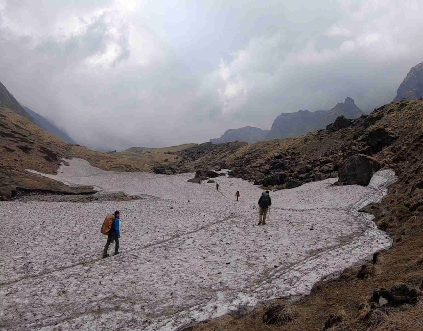
Sandy windy trail follows Kali Gandaki passing Tangbe village with apple orchards and agricultural terraces. Six-seven hour trek crosses bridges and narrow ridges reaching Chele at 2,920 meters. Terrain transitions from river valley to higher plateau landscapes.
Continuation to Geling involves multiple pass crossings including Chele La, Bhena La (3,830m), and Yamdo La (4,010m) creating undulating route. Village of Samar provides midpoint rest stop. Five-six hour day reaches Geling at 3,570 meters with spectacular Nilgiri views.
Days 6-7: Geling to Charang to Lo Manthang
Trail climbs through agricultural fields passing Tama Gaun reaching Nyi La pass at 4,020 meters—trek's highest point. Steep descent to Ghami village (3,510m) shows traditional farming in arid landscape. Final climb to Choya La (3,870m) before descending to Charang.
Final approach to Lo Manthang crosses Charang Chu river ascending rocky trail into Tholung valley. Lo La pass (3,950m) reveals first views of walled capital creating dramatic anticipation. Descending to city completes journey's primary objective after five-six hours walking.
Day 8: Lo Manthang Acclimatization and Exploration
Full rest day allows acclimatization and thorough city exploration. Visiting three major gompas—Jhampa, Thupchen, Chhoeda—requires full day given artistic richness and religious significance. Alternative includes excursion to nearby Tingkar village experiencing additional cultural perspectives.
Understanding monastery visiting protocols including modest dress, shoe removal, and photography restrictions ensures respectful behavior. Monastery fees support religious community maintenance and preservation efforts.
Days 9-12: Return Journey via Dhakmar Route
Long seven-eight hour trek to Dhakmar visits Gyakar village's Ghar Gompa featuring century-old rock paintings. Alternative return route provides different landscape perspectives missed during ascent. Southern mountain views accompany journey.
Syangboche stop offers Dhaulagiri and Nilgiri panoramas during four-five hour walking day. Continuation to Chhuksang passes Chungsi cave monastery dating to 7th century demonstrating region's ancient Buddhist heritage. Final push reaches Kagbeni then Jomsom completing trekking circuit after six-seven hours.
Days 13-16: Return to Civilization
Flight returns Pokhara allowing lakeside celebrations and hot showers washing away accumulated dust. Six-hour drive to Kathmandu includes roadside lunch. Spare day explores capital's UNESCO heritage sites including Boudhanath, Pashupatinath, and Durbar Squares. Final day includes airport departure completing 16-day adventure.
Permits and Regulations
Required Documentation
Upper Mustang Restricted Area Permit costs $500 USD for 10 days with $50 per additional day. Annapurna Conservation Area Permit (ACAP) required at NPR 3,000. TIMS card costs NPR 2,000. Total permit costs approximately $550-600 per person plus guide/porter fees.
Applications process through registered trekking agencies requiring passport copies and itinerary details. Permits checked multiple checkpoints throughout trek requiring careful document retention. Understanding bureaucratic requirements helps avoiding complications during journey.
Group Requirements
Minimum two-person groups required though solo travelers join existing departures. Registered guide mandatory throughout trek with porter services optional though recommended reducing physical burden. Understanding that regulation aims preserving cultural integrity and controlling visitor impacts justifies restrictions.
Physical Preparation and Difficulty
Fitness Requirements
Moderate fitness sufficient for daily five-seven hour walking though high altitude creates additional challenges. Cardiovascular endurance more important than technical skills given established trail nature. Previous multi-day trekking experience beneficial though not essential.
Gradual ascent profile aids acclimatization though elevation 3,000-4,000 meters affects everyone differently. Listening to body signals, maintaining hydration, and accepting rest when needed prevents altitude sickness. Understanding personal limitations encourages conservative pacing.
Acclimatization Strategy
Itinerary designed with gradual elevation gain preventing rapid altitude exposure. Two nights Lo Manthang provides crucial acclimatization time before return journey. Rest day activities keep body active without excessive exertion optimizing adaptation.
Recognizing altitude sickness symptoms—headache, nausea, dizziness, sleep difficulty—enables early intervention. Mild symptoms often resolve with rest and hydration. Severe symptoms require immediate descent and medical attention.
Best Trekking Seasons
Spring and Autumn
March-May and September-November provide optimal conditions combining clear weather, comfortable temperatures, and stable conditions. Post-monsoon autumn offers clearest mountain views though increased trekking traffic. Spring features blooming vegetation lower elevations and moderate visitor numbers.
Rain shadow climate means less monsoon impact than other Nepal regions. However, occasional summer storms occur making autumn/spring preferred despite year-round possibilities.
Monsoon and Winter Options
June-August monsoon brings minimal rainfall given rain shadow effects though some afternoon storms possible. Lower visitor numbers create quiet experience though some teahouses close. Winter (December-February) extremely cold with temperatures far below freezing though crystal-clear visibility rewards hardy trekkers.
Practical Trekking Information
Duration: 16 days total including travel days, 10 active trekking days
Difficulty: Moderate with altitude primary challenge
Best Seasons: March-May, September-November optimal
Group Size: Minimum 2 persons, typically 4-12 participant groups
Accommodation: Basic teahouses and lodges, shared facilities common
Meals: Dal bhat, noodles, soups, Tibetan bread. Limited menu variety at higher elevations.
What to Pack: Four-season sleeping bag, warm layers, wind protection, sun gear, trekking poles, personal medications, water purification.
Frequently Asked Questions
How much does Lo Manthang trek cost?
Complete 16-day organized treks typically $2,000-3,000 per person including permits, guide, accommodation, meals, and transportation. Costs vary by group size and service level.
Can I trek independently?
No, restricted area regulations require registered guides and minimum two-person groups. Solo travelers join existing departures or arrange private guided trips.
Is previous trekking experience necessary?
Beneficial though not essential. Moderate fitness and altitude comfort more important than technical skills. Gradual itinerary aids first-time high-altitude trekkers.
What about altitude sickness?
Risk exists at 3,000-4,000 meter elevations. Gradual ascent and acclimatization days minimize danger. Proper hydration, conservative pacing, and symptom awareness essential.
Are teahouses comfortable?
Basic facilities with simple rooms, shared bathrooms, limited heating. Expecting rustic conditions prevents disappointment while appreciating authentic mountain lodge experience.
Can I visit during monsoon?
Possible given rain shadow climate though occasional storms occur. Fewer visitors and some closed teahouses. Autumn/spring preferred though summer feasible for flexible travelers.
No comments yet. Be the first to share your thoughts!